The app measures the direct distance and angle between any two points on a map. It can register a starting point and destination, and search for locations on the map.
by Looped Picture Company★ 0.00 ratingsNavigationFreeData updated 2026-09-28
Create a travel map to organize memories with photos and color markers. Add location-based images to highlight visited areas. Access photo albums for upload and view travel records as interactive maps.
Measure altitude, latitude, longitude, speed, direction, and atmospheric pressure in real time. View current elevation and compass heading. Display location details including address. Monitor atmospheric pressure values.
Track displays current position, longitude, latitude, altitude, air pressure, magnetic field strength, and speed. Includes real-time positioning and map functionality. Offers 360° rotating styles for direction identification.
Provides electronic campus map for university students. Displays building locations and important areas. Allows navigation within the campus. Includes room information and key site markers.
Locate and unlock using a map interface. View real-time availability and pricing. Track duration and distance. Pay for trips through the . Receive notifications about scooter status and maintenance.
The app provides a database of campsites and camper areas across Italy. It offers search functions by proximity, map, or province, with options for distance, facility features, and services.
Book trips by specifying origin and destination, setting a fare, and requesting a ride. Drivers nearby pick up passengers and take them to their destination. Users determine trip costs and pay directly.
View real-time traffic via webcams on Belgian freeways. Check traffic incidents sorted by distance. Access a detailed map of Belgium. See fixed and mobile radars. Report issues or suggest improvements via email or social media.
The app helps users navigate the West Side Nut Club's Fall Festival. Users can search food and booth listings, view booth locations on a map, and create custom lists of desired items.
The app provides a subway map and route planner for navigating Kyiv's subway service. It includes trip cost calculation, station finder with augmented reality, and offline map availability.
Save locations by tapping to add notes, tags, and categories. Plan routes with multiple points and choose navigation modes. Track location history and view saved places on a map.
The app provides direct connection to the nearest available taxi in Timisoara or Ploiesti. Users can track their assigned car on the map from allocation to destination and rate the service provided.
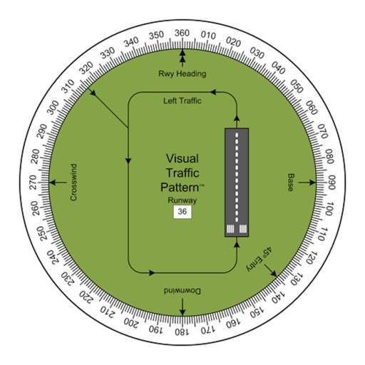
Allows pilots to view runway patterns with finger rotation. Display includes left and right patterns, crosswind, downwind, base, and 45-degree entry headings. Magnetic runway orientation matches aircraft heading for approach visualization.
The app records vehicle travel data, displaying real-time measurements like speed, distance, and altitude. It offers features such as trip recording, customizable themes, speed limit alerts, and HUD mode.