
Shralp Tide 2
Michael Parlee
Graphical tide display on Apple devices.
The app provides graphical tide displays for Apple Watch, iPhone, and iPad. Users can view tide graphs, highs, lows, and select locations.

Track and in time
Calculate in time using GPS location. Access worldwide marine charts and 15000+ tide and current spots. No internet connection required. View tidal data without entering coordinates.
Showing 481–500 of 1,000 ranked alternatives.
Michael Parlee
Graphical tide display on Apple devices.
The app provides graphical tide displays for Apple Watch, iPhone, and iPad. Users can view tide graphs, highs, lows, and select locations.

Colin Porteous
Track tidal streams and measure set rates
Displays real-time tidal stream data based on the nearest Devonport high water time. Shows hourly streams charts valid for specific periods. Allows users to view tide set and interpolated rates. Functions fully offline without internet connection.

Dedaldev Doo
Pin locations and navigate quickly
Mark locations on maps by pinning or entering GPS coordinates. Organize saved places into folders and access favorite spots quickly. Navigate using integrated Google Maps or preferred mapping services.





JOHN W GRANHOLM
Track time, location, and direction
Displays a 24-hour analog with a sweeping second hand. It shows GPS coordinates, heading, and compass bearing based on device orientation. It uses location data in the foreground without saving or transmitting personal information.




eTips LTD
Offline travel guides for Spain.
The app provides offline travel guides for multiple Spanish cities and regions. It features augmented reality, offline maps, local audio, and GPS capabilities for interactive points of interest and navigation.

Black Cat Systems
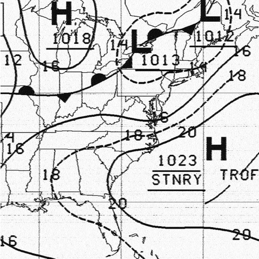
Receive faxes via HF radio
Receive and display marine fax images using HF radio audio. Connect via Bluetooth or audio input. Tune to fax frequencies. View real-time reports without internet.


John Spinks
Locate position on OS maps
GPS OS allows users to determine their location on Ordnance Survey maps of Great Britain and Ireland without needing a phone signal. It provides high-accuracy positioning using OSTN15 transformation data.

Generative Pictures LTD
Navigate with accurate GPS and coordinates
Display GPS coordinates in DMS, DDM, or DD formats. Show altitude in feet or meters. Track speed with a speedometer. Share coordinates. Switch between magnetic and geodetic north. Use flashlight for nighttime. Provide location data.
Apps are ranked by functional similarity, category fit, rating confidence, and popularity.