Real-time disaster prevention information service.
The app provides real-time disaster prevention information. Users can download the service via smartphone to access the latest updates on potential flooding.
by SanChuanCloud Tech ,Ltd★ 0.00 ratingsWeatherFreeData updated 2026-09-24
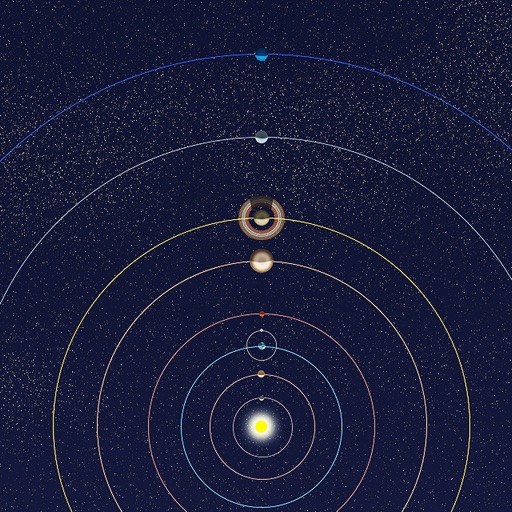
View positions of all solar system planets at any date. Adjust time to see real-time movements. Display accurate orbit sizes, eccentricity, and orbital shapes based on NASA data. Show realistic planet sizes relative to each other.
Access real-time weather forecasts and radar updates. Customize the home screen with weather modules. Add and configure location alerts. View live TV streams and latest news updates. Track investigative journalism and local content.
The app provides tide information for coastal activities. It offers tide times, heights, and coefficients for 140 ports in mainland France and the Channel Islands.
Provides real-time translation across 120 languages. Users can translate spoken words instantly and converse in different languages. The also translates text in , such as menus, by pointing the camera at the text.
Report crimes and emergencies in real time. Access office contact information and department updates. View crime statistics and safety alerts. Submit tips and receive notifications about ongoing investigations.
The app provides current recreational water quality information for over 8,000 beaches, lakes, and rivers. Each location displays a green or red icon indicating if the water quality is suitable for swimming.
Provides and behavioral resources for County residents. Includes acute and outpatient care information, suicide prevention tools, and Narcan training. Allows users to create a personal safety plan with harm reduction steps.
Access detailed product information, installation guides, and technical specifications for materials. Search for articles and videos on building techniques and industry trends. Stay updated with the latest industry news and practices.
Track satellites in real time with world map and overhead sky views. Identify satellites and the International Space Station with orbit . Determine dish orientation for geostationary satellites using GPS. View passes for any location.
Compressor technician's essential information tool.
The app provides technicians with a centralized tool for compressor information. It offers features like a controller password journal, altitude correction, and various calculation tools for system efficiency and maintenance.
Prepare for the DMV with practice questions based on the latest driver's manual. Review explanations for incorrect answers. Access state-specific content to ensure accurate information for applicants.
Track real-time surf conditions at 300+ high-definition cameras across Brazil, Peru, El Salvador, and Panama. View live footage of major surf breaks 24/7. Access surf forecasts and beach conditions. Monitor wave heights and weather data.
View real-time satellite cloud imagery and interactive maps. Access colour-coded weather alerts by severity. Get accurate 10-day forecasts with hourly details. Save favorite locations. Use integrated GPS and compass for location awareness.
The app provides access to station content for mobile users. It includes 250 meter radar, future radar, high-resolution satellite imagery, and current weather updates.
CHARLESTON COUNTY SCHOOL DISTRICT DEVELOPMENT CORPORATION
District news and school information.
The app provides a personalized view of district and school activities. Users can access news, a tip line, notifications, and the directory, with parents and students able to manage contact information.
Translate text, menus, and signs with accurate language conversion. Convert spoken words to text in real time. Use image recognition to translate visual content. Switch between multiple languages for global communication.
Scan and identify cards using your phone's camera. View real-time market prices, rarity, and set details. Track and manage collections with organization tools. Monitor values and receive live updates.
Track positions in real-time with precise, instant calculations. View over 5000 satellites and their current locations. No offline sync available due to data volume and frequency updates.
Critical emergency reference information available now.
The app provides quick navigation to critical information, including ACLS algorithms, drug dosages, and medical emergencies. It features custom bookmarks, search capability, and the ability to add notes to pages.
Access real-time public safety updates and news from LAAPOA, AAAPO, and the BOLO Newsletter. View press releases, union events, legal updates, and benefits information. Stay informed on member services and organizational activities.