The app displays real-time G-force measurements, including backward, left, and right directions. It includes a peak hold function to show maximum G-forces in each direction.
by SHIGEYUKI TAKAHASHI★ 0.00 ratingsNavigationFreeData updated 2026-09-22
Monitor vehicle performance with real-time engine data, speed, and sensor readings. Receive alerts for anomalies and track diagnostic trouble codes. Sync with CarPlay or smartphone via Bluetooth. Supports iPad as standalone device.
The app offers VFR and IFR pilots an affordable, capable, and usable electronic flight bag. It provides pilots with necessary information for safe flight, featuring an intuitive interface and pilot-focused support.
Align antenna by selecting a and viewing horizontal and vertical alignment directions. Check for obstacles affecting reception. Choose from over 400 satellites.
Monitor speed with unit switching between KM/H, MPH, and KTS. View analog or digital speedometer displays. Track journeys with detailed logging and route mapping. Integrate music playback and receive real-time weather updates.
Provides readings using either device GPS or the ASTER digital elevation model. Displays accurate elevation data with a horizontal accuracy of 30 meters. Functions on devices without a GPS sensor.
Track heart rate, body temperature, skin conductance, and respiration using TPS eVU sensor. Set performance goals, monitor progress, and adjust training based on biometric data. Sync data across devices and view detailed analytics.
Navigate with voice-guided turn-by-turn directions in multiple languages. Plan door-to-door routes. View upcoming maneuvers and distances. Access offline for 200+ countries. Receive speed limit and camera warning alerts.
The app displays straight-line and driving distances to a destination. Users can set destinations via search or map selection, with real-time distance and direction updates.
Track flights by logging and improving them using Vario with sensor fusion and sound alerts. Monitor ground speed, altitude, wind speed, and direction. View live maps and fly with friends. Sync with Apple Watch.
Locate parked cars using augmented reality and radar tracking. Save locations with a timer to avoid parking fines. View simple map views and set alerts for parking duration.
Adjust power settings and monitor ride statistics in real time. View detailed ride logs and track performance metrics. Connect via Bluetooth to the TC500 . Receive firmware updates and manage device settings remotely.
Guide users through dynamic warm up routines to improve joint mobility and circulation. Offer static cool down routines to aid muscle recovery. Provide a simple interface for easy navigation and execution of stretches.
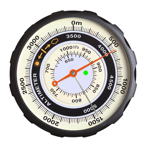
Displays altitude using a digital readout and an analog gauge. Tracks maximum height reached during use. Shows altitude accuracy and sensor quality. Utilizes GPS and barometric sensor for precise measurements.