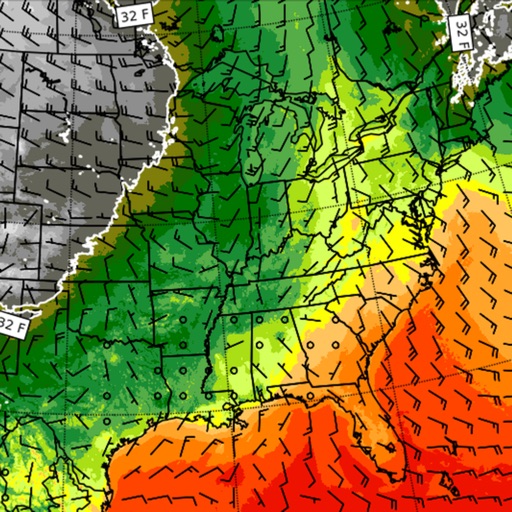
The app displays atmospheric and oceanic data in GRIB format using a 3D HD interface. Users can view animated weather data, select specific models, and download relevant characteristics for a holistic view of sea conditions.
by APP4NAV★ 5.01 ratingsWeather$17.99Data updated 2026-09-17
View current updates multiple times per hour. Access high-resolution satellite imagery and 250-meter radar. Check hourly and daily forecasts from computer models. Add and save favorite locations. Use integrated GPS for location-based data.
Get precise forecasts for any location using GPS or manual input. View 7-day forecasts with hourly updates and detailed metrics like temperature, precipitation, wind, and rainSPOT. Access 5-day meteograms and track predictability.
Access real-time data with high-resolution radar and satellite imagery. View current conditions and forecasts updated hourly. Add and save favorite locations. Track severe movement with future radar predictions.
Secure data transmission with AES encryption and IP masking. Prevents data eavesdropping and tracks no online activity. Auto-secures public Wi-Fi connections. Protects personal data on iOS and Mac devices.
Hefei Single Machine Placement Technology Co., Ltd.
Encrypt connections and protect data
Securely encrypt internet traffic to hide online activity. Connect to global servers in America, Europe, and Asia. Tap to activate protection against cyber threats. Switch servers by selecting flags.
Access real-time data with high-resolution radar and satellite imagery. Track severe trends and view current conditions updated frequently. Save favorite locations and use integrated GPS for location-based alerts.
Access real-time updates with multiple hourly refreshes. View high-resolution radar and satellite imagery. Track severe trends with future radar predictions. Save favorite locations and use integrated GPS for location-based alerts.
View current updates multiple times per hour. Access high-resolution satellite imagery and 250-meter radar. See future radar for severe direction. Add and save favorite locations. Use integrated GPS for location awareness.
Displays wind and gust forecasts with live data from 30000+ weather stations. Shows wave info including swell, period, and energy. Tracks , currents, and real-time wind. Lists over 75000 spots sorted by location and type.
Access real-time weather data with high-resolution radar and satellite imagery. View current conditions and forecasts updated hourly. Add and save favorite locations. Track severe weather movement with future radar predictions.
View current updates multiple times per hour. Access high-resolution satellite cloud imagery and 250-meter radar. See future radar for severe movement. Obtain daily and hourly forecasts updated hourly.
The app provides Suncoast weather information including an interactive radar map, current conditions, and a 10-day forecast. Users can access station content, view future radar, and receive severe weather alerts from the National Weather Service.
Access real-time data with high-resolution radar and satellite imagery. View current conditions and forecasts updated hourly. Add and save favorite locations. Use integrated GPS for location-based alerts and tracking.
The app provides 15-day and hourly weather forecasts, severe weather alerts, and radar images. It includes air quality, earthquake data, and tide predictions.
View current updates multiple times per hour. Access high-resolution satellite imagery and 250-meter radar. Track severe with future radar predictions. Save favorite locations and use integrated GPS for location-based forecasts.
View current weather updates multiple times per hour. Access high-resolution satellite imagery and 250-meter radar. See future radar for severe weather movement. Save favorite locations. Check daily and hourly forecasts from computer models.
View current updates multiple times per hour. Access high-resolution satellite imagery and 250-meter radar. See future radar for severe direction. Add and save favorite locations. Use integrated GPS for location awareness.
Access real-time updates multiple times per hour. View high-resolution satellite imagery and 250-meter radar. Track severe with future radar projections. Add and save favorite locations. Use integrated GPS for current location data.