Stream GPS NMEA data to external devices in real time. Send location information over IP for use with mapping or navigation software. Requires a computer or compatible device to receive data.
by Angus Oliver★ 4.215 ratingsNavigation$7.99Data updated 2026-10-09
Plan routes based on vehicle specifications like height, weight, and axle count. Avoid restricted areas and hazardous materials zones. View real-time traffic and fuel cost estimates. Save and share optimized routes.
Enable global connectivity with a digital SIM that supports 5G in 200+ countries. Switch carriers and plans instantly. Access free data for navigation and sharing. Connect to local networks without physical SIM swaps.
Track location data using GPS and other methods. Store data in iCloud for access via the website. View heatmap visuals of traveled areas. No data stored on developer servers. Background location requires permission.
Create a realistic flight simulation cockpit with a Boeing-style Flight Management System, Primary Flight Display, and Navigation Display. Connect to flight simulators via local network. Configure displays for different simulators.
The app allows users to plan custom bike routes in The Netherlands, Belgium, and Germany using nodes. Saved routes can be shared via mail and include GPS navigation with spoken directions.
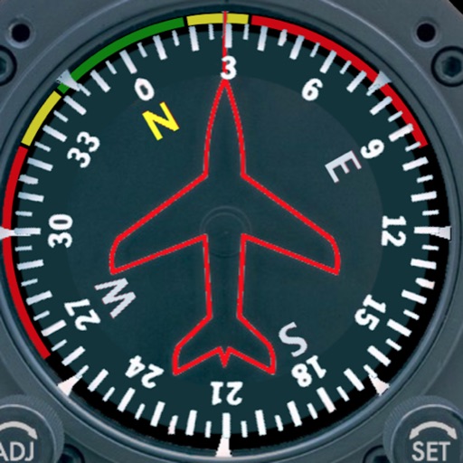
Displays a photorealistic -style indicator with both analog and digital readouts. Users can toggle rotation lock, simulate the instrument indoors, and view improved graphics. Supports latest iOS versions and includes bug fixes.
Track aircraft position using device GPS. View real-time data including altitude, speed, and heading. Access weather information and airport details. Set and monitor plans. Receive alerts for airspace changes and terrain obstacles.
Find nearby food, drinks, and desserts with interactive map results. Tap for details like name, address, phone, and website. Share via social media, text, email, or AirDrop. Get point-to-point navigation to locations.
Monitor speed and red light traps using GPS data. Receive customizable alerts for upcoming dangers. Integrate with an external device for real-time updates. Log and review trap locations. Set personalized warning preferences.
Monitor electric vehicle state of charge, door/trunk/hood status, tire pressures, temperatures, and system temperatures. View live GPS location and check vehicle status remotely.
Turn-by-turn navigation for Australia New Zealand.
The app offers turn-by-turn navigation for Australia and New Zealand with offline map data. It includes SpeedAlert for national speed limits, school zones, and time of day, along with CarPlay support and HERE live traffic.
Navigation allows users to plot courses, measure distances, and mark waypoints on digital charts. It supports traditional navigation methods without GPS, including manual plotting and paper chart integration. Users can save and share route data.
Track trips with distance, time, and average speed calculations. Forecast arrival times using waypoints. Monitor GPS and OBD sensor data in real time. View detailed vehicle performance metrics. Sync with external GPS devices for enhanced navigation.
Measure areas using GPS or manual map points for accurate calculations. Switch between and distance modes. Save measurements for later access. Use compass navigation for directional guidance.
Track vehicle movement with real-time GPS updates. View and save travel routes. Receive location data and map navigation. Set up alerts for unauthorized movement. Share location with contacts. Sync with devices for remote monitoring.