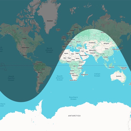
Calculate sunrise and sunset based on GPS location. Track time until next sunrise or sunset. Plan outdoor activities like running, hiking, and biking using accurate daylight schedules.
by David Neel★ 4.04 ratingsUtilitiesFreeData updated 2026-09-08
Track conditions with hyperlocal forecasts for over a million locations. Receive lightning alerts and lunar calendar updates. Swipe the Wheel to explore forecasts. Listen to immersive audio for each element.
Check current weather conditions including pressure, temperature, and UV index. View hourly and daily forecasts. Add worldwide locations. Access wind gust data and sunrise/sunset times. Remove ads for a premium experience.
Track sun and moon positions on a live map for golden hour, blue hour, sunrise, and sunset planning. Calculate ND filters, depth of field, motion blur, and exposure settings. Plan timelapses and estimate print quality from pixel data.
Determine location using GPS and MGRS coordinates. Display latitude, longitude, and altitude. Show 16 main directions. Operate offline. Suitable for camping and outdoor navigation.
Plan trips to parks with downloadable and guides. Access over 100 parks, state parks, and monuments. View 170+ from government agencies. Find 1,000+ campgrounds and campsites. Includes motor vehicle use and visitor for national forests.
Plan trips to parks with offline and guides. Download detailed park , motor vehicle use , and visitor . Access 4,100+ campgrounds and 2,300+ trails. View information on national parks, state parks, and monuments.
Plan trips to with AI-generated itineraries and offline GPS maps. Access expert-written guides and real-time alerts for trail, road, and weather conditions. Log hikes and track progress. Sync with Apple Health.
The app displays dates in Bikram Sambat (B.S.) alongside corresponding Gregorian calendar dates. It includes daily sunrise and sunset times, tithi, moon phases, and public holidays.
Plan trips to parks by downloading , brochures, and newspapers. Access 100+ parks, 25+ folded from various agencies, 300+ campsites, 2,000+ trails, and 75,000+ points of interest. Save data for offline use in areas without Wi-Fi.
Control smart devices with native support for Milight, LimitlessLED, EasyBulb, LIFX, Belkin WeMo, Indigo, and URL calls. Trigger actions via geofences, schedules, or voice recognition. Add custom attributes to commands.
Track phases with a monthly showing each phase's date and time. View lunar events like eclipses and full moons. Set reminders for specific events. Share phase data via social media or email.