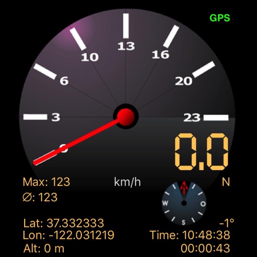
Display speed limits and alert for overspeeding. Show speed camera locations and distance. Provide average and maximum speed tracking. Include odometer and unit selection for KMH/MPH. Display current road name, weather conditions, and temperature.
Navigation allows users to view and share GPS coordinates in six formats. It includes a , altitude, distance, and sunset/sunrise tracking. Users can set and edit waypoints with photo or audio notes.
Calculate altitude using GPS, ASTER, or barometer (iPhone 6 and later). Display average altitude from GPS and ASTER data. Show peaks, compass, and distance grid on an integrated map. Support Apple Watch. Choose unit of measurement.
Track and distance in miles and kilometers with real-time updates. Switch between KM/H and MPH modes. Display average and maximum . Show altitude and compass. Monitor GPS signal accuracy. Use analog . Work offline without internet.
Track speed, distance, altitude, and heading using GPS. View latitude and longitude coordinates. Monitor sunrise and sunset times. Record acceleration data. Save journey logs for later review. Share trip details via email or social media.
Tracks bicycle rides with real-time GPS and Bluetooth sensor data including speed, distance, elevation, calories burned, cadence, and power. Maps routes and saves ride history. Displays elevation changes and performance metrics.
Navigate with voice-guided turn-by-turn directions in multiple languages. Plan door-to-door routes. View upcoming maneuvers and distances. Access offline for 200+ countries. Receive speed limit and camera warning alerts.
Navigation allows users to view direction aligned with satellite imagery or maps. Displays street address, GPS coordinates, elevation, and What3Words codes. Taps switch between satellite and map views. Pinch or spread to zoom.
Provide offline with detailed points of interest. Record GPS tracks and bookmark locations. Receive turn-by-turn navigation with voice instructions in nine languages. Choose routing options for driving, cycling, walking, or shortest distance.
Displays current speed in both miles per hour and kilometers per hour. Automatically switches speed units based on the country's standard. Shows real-time speed data from the device's sensors.
View 3D and 2D side by side. Tap or hold to specify locations. Adjust 3D map angles. Search for addresses and locations. Use compass and GPS. Access real-time traffic data. Switch to full screen. Search Wikipedia. Control map zoom from Apple Watch.
Identify stars, planets, and constellations using real-time sky maps. Point device to locate celestial objects. View satellite passes and track planetary movements. Receive detailed information on selected objects.
Connect to SHIMANO -BIKE, Di2 drivetrain, and sensors via Bluetooth® LE. View speed, assist mode, and gear changes. Display routes and recorded data for review. Requires SHIMANO ID registration.
Track speed, max speed, average speed, distance, travel time, and stop time. Measure acceleration from 0 to 60 mph. Receive speed limit warnings in HUDWAY mode. Displays trip data in a digital GPS speedometer format.
Vehicle with GPS for cars, bikes, and boats. Display in mph, km/h, and knots. Use analog ranges for different vehicle types. Monitor odometer readings for distance traveled.