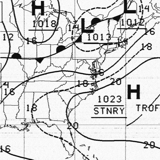
HF Weather Fax
Black Cat Systems
Receive faxes via HF radio
Receive and display marine fax images using HF radio audio. Connect via Bluetooth or audio input. Tune to fax frequencies. View real-time reports without internet.

Track wind, waves, and surf conditions
View marine forecasts for U.S. coastal zones. Check wind speed, wave height, and surf conditions. Access one-touch NOAA forecasts for today, tonight, and the week. Add locations for custom alerts.
Showing 381–400 of 1,000 ranked alternatives.
Black Cat Systems
Receive faxes via HF radio
Receive and display marine fax images using HF radio audio. Connect via Bluetooth or audio input. Tune to fax frequencies. View real-time reports without internet.


Flytomap
Navigate with marine and outdoor maps
Navigate with offline marine, lake, and outdoor maps. Access worldwide satellite and terrain overlays. View local weather forecasts. Use NOAA, USGS, and DRG data for detailed charting.

Boaz Nechemia
Jerusalem weather forecast and live conditions
The app provides a 6-day weather forecast for Jerusalem. Users can view current significant conditions, a 24-hour detailed forecast, live pictures, and a rain radar.

Lin Huang
Track and updates
View real-time and forecasted images for land and sea. Check precipitation maps and track patterns. Receive hyperlocal updates. Set location-based alerts. Share data with others.

Dmytro Hubenko
Track , , and alerts
View real-time images for current conditions. Track storm movements and severe alerts. Set location-based notifications. Access detailed forecasts and temperature data. Share updates with others.
Calculated Industries, Inc.
U.S. Coast Guard approved boating procedures.
The app provides information and procedures for boaters. It contains approved methods and procedures for Coast Guard boat operations, serving as a primary reference for training.

Flytomap
Explore maps without mobile coverage.
The app provides worldwide marine and outdoor maps, satellite imagery, and terrain overlays. It includes local marine weather forecasts and community information for boaters.

Brian Krupp
Check by location
Check current , temperature, and conditions. View forecasts for upcoming days. Access dew point readings. Use location data only for retrieval. Add widgets to home screen. Sync with Apple Watch.



G Sanghani
Track speed, distance, and trip time
Tracks current, maximum, and average speed using GPS. Displays speed in analog and digital formats with colorful LED. Records distance traveled and trip time. Functions as a trip meter and for vehicles, walking, running, biking, and boating.


Flytomap
Navigate with marine and outdoor
Navigate with marine and outdoor offline. Overlay satellite and terrain data on charts. Access local weather forecasts. View worldwide and satellite imagery when connected. Use NOAA raster data for detailed navigation.


P4G Pty Ltd
Wind and weather for Melbourne.
The app provides current wind conditions and forecasts for Melbourne and Victoria. It maps locations by wind speed and distance, offering marine forecasts, weather forecasts, and radar imagery for the region.


Apps are ranked by functional similarity, category fit, rating confidence, and popularity.