
Amsterdam Map and Walks
GPSmyCity.com, Inc.
Explore the city on foot.
The app provides self-guided walks with city maps, featuring attractions and hidden gems. Users can explore at their own pace, track steps, and share photos.

Explore 3D terrain and buildings
Create and collaborate on detailed maps using satellite imagery and 3D terrain. Explore cities with 360° Street View. Add annotations and share maps with others. Navigate streets and view neighborhood details.
Showing 601–620 of 1,000 ranked alternatives.
GPSmyCity.com, Inc.
Explore the city on foot.
The app provides self-guided walks with city maps, featuring attractions and hidden gems. Users can explore at their own pace, track steps, and share photos.


Coptologia Publications, Inc
Explore the Coptic Orthodox world.
The app displays Coptic Orthodox churches and monasteries on a map. It provides real-time data, localized distance calculations, one-touch dialing, and a 360° view of destinations.


GPSmyCity.com, Inc.
Explore , discover landmarks, navigate city streets
Explore self-guided walking tours with detailed city maps. Navigate to attractions and hidden spots. Set waypoints and track your route. Receive turn-by-turn directions. Save favorite locations and share maps with others.
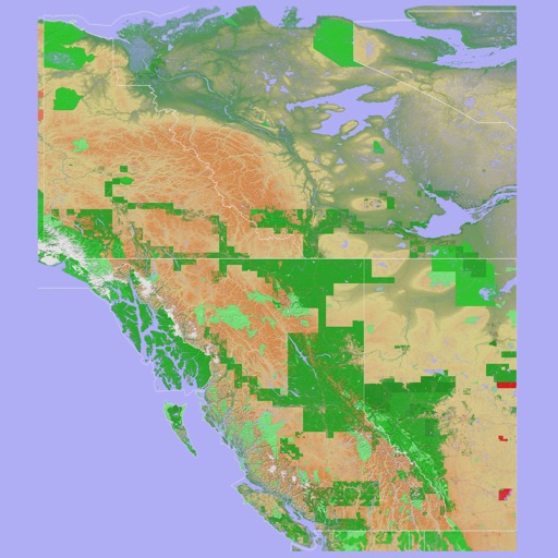
Mark Granger
3D topo map of Western Canada
The app provides a 3D topographical map of Western Canada. Map data downloads to the device for use without an internet connection, allowing users to view terrain features as small as ten meters.

GPSmyCity.com, Inc.
Explore cities with self-guided walks.
The app provides self-guided walks with city maps, allowing users to explore attractions at their own pace. It includes features like street search, location bookmarking, and movement tracking.
GPSmyCity.com, Inc.
Explore cities with self-guided walks.
The app provides self-guided walks with city maps. Users can explore attractions and hidden gems at their own pace.


VoeTek Ltd
Explore London's historic streets interactively.
The app offers an interactive exploration of London's historic streets, featuring nearly 70 streets and over 100 historic and contemporary images. It includes five historic maps and three Victorian-style inventions for an engaging experience.

sattam alyusuf
Explore routes and rituals
Plan or Umrah journeys by accessing interactive maps for landmarks, prayer sites, and accommodations. Locate essential services and navigate crowded areas. Set reminders for rituals and schedules. Share real-time updates with travel companions.


Cesar Ibarra
Find spots
Explore curated spots in Guatemala. Search and save favorite cafés. View details like menus and locations. Get recommendations based on preferences. Share favorite spots with others. Navigate using integrated maps.

Inside Outside Studios Inc.
Find map layers and track your location
Access real-time location data and choose from over 70 map layers for detailed boundary and land ownership info. View satellite, topographic, hybrid, and road maps. Set permissions and contact details for areas you visit.


Apps are ranked by functional similarity, category fit, rating confidence, and popularity.