

Apps Like ARange for iPhone and iPad
ARange screenshots
Ranked alternatives
Showing 321–340 of 1,000 ranked alternatives.


License Plate Wiki & Collect
Yannick Lung
Spot plates, learn their origin, plates
View details with an interactive map showing European plates. and track plates with statistics. Share collections with others. Identify origins and learn about formats.


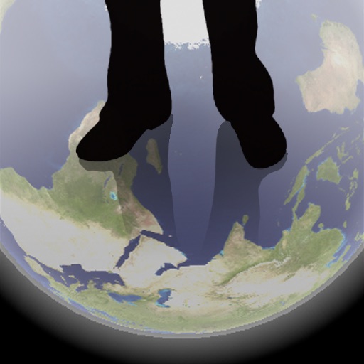
Transparent Earth -See the other side of the earth
Makoto Sato
See through the earth's surface.
The app shows a transparent view of the earth, allowing users to see the other side of the world beneath their feet. It displays the positions of major cities on a reversed blue marble through a camera overlay view.

DriveMind: Dash Cam & Mileage
Jesvin Jerry
Log trips automatically and view details
Automatically records trips when driving starts, capturing distance, route, speed, and other details. View trip summaries upon arrival. Track personal or business driving data without manual input.
Field Area Measure - Land GPS
Anastasiya Evseenko
, track distances, calculate areas
Distances, perimeters, and areas by placing pins on a map. Calculate results in square meters. Save and share measurements for planning and analysis.



Sola – Bible reading plans
Samuel Jusaitis
Read Scripture, create , share with others
Read passages with customizable set for specific texts and durations. Join group to share progress with others. View maps of biblical locations relevant to current readings. Explore a timeline of key events, rulers, and books within the text.


Kyiv Metro Guide and Route Planner
Discover Ukraine LLC
Navigate Kyiv using the subway.
The app provides a subway map and route planner for navigating Kyiv's subway service. It includes trip cost calculation, station finder with augmented reality, and offline map availability.


US Climate Awareness
Nathan Seungwon Han
Check actions and track local data
Provides daily action checklists for mitigating change. Displays city-specific data including ozone levels, toxic air releases, and traffic proximity. Lists vulnerable cities ranked by ozone percentage and environmental factors.



CoordCalc
Justin Graham
Calculate distance and bearing between points.
The app calculates distances and bearings between two points using latitude and longitude. It can also determine a final position from a starting point, distance, and bearing.
How we rank alternatives
Apps are ranked by functional similarity, category fit, rating confidence, and popularity.