Stay updated with real-time aviation news and industry updates. Connect with professionals by following users and engaging in discussions. Post job opportunities and share industry insights.
Create profiles, book arrivals, track reservations
Create profiles to access customer information. Make arrival and departure reservations. Book hotel and rental car services. Review MRO work order status. View transaction history and point balances for loyalty program members.
Track flights, view aircraft, and follow destinations
Track flights operated by , view aircraft models, and check flight speeds. Monitor destinations and flight paths. Receive real-time updates on flight status and arrival times. Explore pilot perspectives and aviation details.
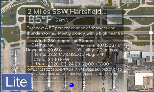
The app displays aviation weather observations and forecasts using a maps-based interface. Users can view METARs and TAFs in coded or translated formats, with color-coded pins indicating forecast or observation availability.
Travel "Access 24/7 multilingual support for health issues, legal problems, lost luggage, passports, or documents. Book travel insurance, locate embassy contacts, and receive emergency worldwide."
Book rides by tapping your phone. Get picked up at nearby locations. Share rides with others heading the same way. Save costs and reduce emissions through shared transportation.
Find and unlock nearby electric vehicles for short trips. Register or log in to access the service. Pay for rides with affordable rates. Earn free rides by referring friends. Track trip details and manage account settings.
Plan trips with detailed maps and points of interest. Explore hiking trails, biking routes, and horseback riding areas. View wildlife information and local attractions. Book accommodations and access event calendars.
Plan National Park trips with real-time updates and travel tips. Record past trips with logs and photos. Ask AI Ranger Parky questions about park details. Track hikes, viewpoints, and interactions. Earn achievements for completed activities.
View turbulence reports and overlays on Apple Maps. Access hundreds of aviation and weather maps. Filter turbulence data by time and altitude. Share turbulence maps with others. Retrieve detailed turbulence information with a tap.