Displays real-time traffic and satellite views. Shows current location and allows address input. Measures land area and calculates radius and corners. Shares location via email, SMS, or social networks. Auto-updates direction based on movement.
The app records strike and dip measurements, bearings, and plunge. It simultaneously displays the user's latitude, longitude, and elevation, and saves measurements with photos and notes.
Coordinates can be viewed and shared via decimal degrees, degrees-minute-seconds, degrees-minute-decimal, UTM, and military grid systems. Users can tap a map to retrieve coordinates and directions.
Locate direction using GPS and compass. Display map with current location and direction. Use accelerometer to adjust orientation. Show prayer times based on location. Track daily prayer schedule.
Track physical objects using barcode scanning. Locate items with GPS coordinates. Collect data on usage and location. Sync with desktop software and mobile . nd print barcode labels. View object history and current status.
Find ZIP codes using street addresses, city and state, or existing ZIP codes. Retrieve ZIP codes for locations across all 50 US states. Enter full street addresses to locate corresponding ZIP codes.
The app provides a worldwide repeater directory with comprehensive search and sorting capabilities. It displays distance, heading, and full repeater details without requiring a network connection.
The app displays skew-t log-p charts with temperature, dew point, and winds aloft. It shows current radar, Airmets, Sigmets, and SkewT data filtered by altitude.
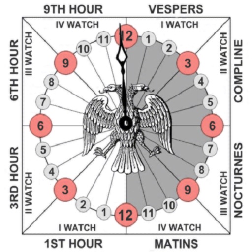
Track prayer times based on time calculations. Adjust for location using GPS or manual input of coordinates. Display times in 12-hour format starting at evening. Include historical context about ancient Judean timekeeping methods.