Locate direction using GPS and compass. Display map with current location and direction. Use accelerometer to adjust orientation. Show prayer times based on location. Track daily prayer schedule.
by UMRA TECH LLC★ 4.29 ratingsNavigationFreeData updated 2026-09-06
Turn your iPhone or iPad into an outdoor GPS or marine chart plotter. Use detailed Topo maps or NOAA marine charts for navigation. Access maps offline without a network connection. View GPS location without mobile signal.
The app provides location-based daily prayer times with a 24-hour clock and remaining time to the next prayer. It offers monthly prayer times, a world prayer clock for any location, and Qiblah direction finding.
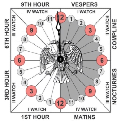
Track prayer times based on time calculations. Adjust for location using GPS or manual input of coordinates. Display times in 12-hour format starting at evening. Include historical context about ancient Judean timekeeping methods.
Track prayer counts with customizable targets of 33 or 99. Reset progress at any time. Customize beads from 15 available options. No in- purchases. Save and share prayer sessions.
Provides real-time device orientation based on magnetic fields. Allows switching between true and magnetic north. Displays compass direction and azimuth. Includes declination information. Offers tilt sensitivity settings.
The app finds nearby places like restaurants, ATMs, and parks. It offers navigation, place details, and live weather information for the user's current location.
Locate nearby docking stations with distance and direction. View available and docks at each station. Use full-map mode to check docks at destinations. Set a ride timer to track rental duration and avoid late fees.
The app displays GPS information including address, latitude, longitude, altitude, and speed on a map. It also shows directions for north, south, east, and west, along with true and magnetic north.
The app displays straight-line and driving distances to a destination. Users can set destinations via search or map selection, with real-time distance and direction updates.
Find routes with real-time traffic updates and voice-guided . View 3D aerial and use a digital compass for orientation. Plan trips with AI-generated itineraries and track progress toward destinations.
The app provides a compass for direction, a map for location and navigation, and an altimeter for measuring height above sea level. It also offers a sharing feature to send current positions with pictures and text to contacts.
Determine with precise compass readings in degrees and cardinal points. Track real-time orientation as you move. View current coordinates and altitude. Calibrate compass for accuracy.