View real-time river gauge data for specific locations along the Upper Mississippi River. Monitor water levels, flow rates, and historical trends. Receive alerts for significant changes. Share data with other users or save for later reference.
View for over 9,000 stations across 40 countries. Locate nearby automatically. Set custom alerts for specific locations. Track high and low schedules. Share data with others.
View tidal data, solar and lunar times, and forecasts in one interface. Check tide predictions, advisories, and sun/moon schedules. Plan activities like fishing, boating, or diving based on real-time and forecasted conditions.
Tap on a map to view spot-specific forecasts. Check , sky, wind, and wave conditions. Access severe advisories and offshore zone summaries. View hourly tides and interactive tide graphs.
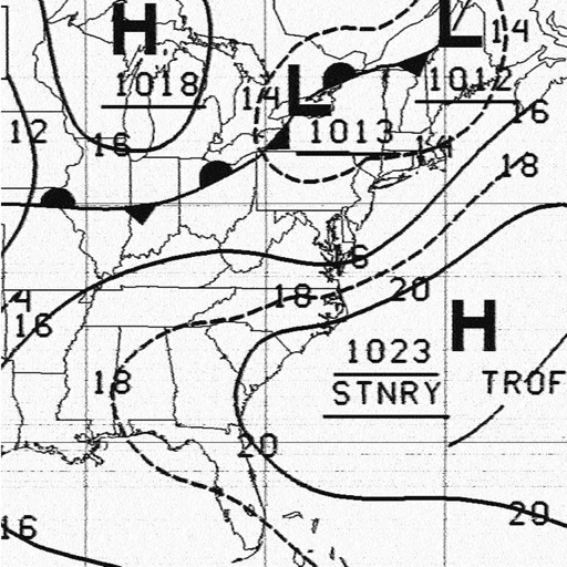
Receive and display marine fax images using HF radio audio. Connect via Bluetooth or audio input. Tune to fax frequencies. View real-time reports without internet.
View live weather radar and satellite imagery. Track precipitation types and lightning. Access high-resolution forecasts using advanced models. Set location-based alerts. Share weather data with others.
The app provides marine weather data including wind speed, surf, and wave height for coastal zones in the United States. It offers one-touch National Weather Service forecasts for today, tonight, and the week, along with small craft advisories.
Calculate in time using GPS location. Access worldwide marine charts and 15000+ tide and current spots. No internet connection required. View tidal data without entering coordinates.
View real-time radar and satellite maps to track storms and clear skies. Receive rain alerts and access hourly forecasts. Get local updates using location services. Display on home screen with a widget.
View real-time maps showing precipitation types like , snow, and hail. Access detailed 24-hour and 14-day forecasts for any location. Receive severe weather alerts and track current conditions globally.
View real-time satellite and radar imagery for . Track hurricanes, typhoons, and tropical in Atlantic and Pacific oceans. Receive severe thunderstorm and tornado alerts in the US. Access UV index, marine data, and animated forecast charts.
Access real-time weather data and live wind reports for sailing activities. View for racing, sailing, and cruising. Locate Tempest Weather Systems near shore markers, buoys, piers, yacht clubs, and waterfront areas.
Access real-time sea surface temperature maps, high-definition satellite imagery, and marine weather . Track water color, currents, tides, and moon phase. Mark and save GPS locations for temperature breaks and color barriers.
View current and forecasted weather with six-day data. Check radar and satellite imagery. Track wind, rain, tide, swell, and UV levels. See moon phases and sunrise/sunset times. Locate specific areas for detailed forecasts.