Measure distances using augmented reality or direct phone contact. Calculate surface areas and angles. Create floor plans and save measurements. Share results via email or messaging.
Calculate area and cost based on entered dimensions or house size. Input measurements to get automatic estimates. Export results for reference and share with professionals.
Detect metals and magnetic fields with a built-in . Identify hidden cameras and other objects. Scan environments for security and home improvement tasks. Save and share scan results.
Calculate using coordinates with options for square meters, feet, acres, hectares, kilometers, and miles. Measure distance between points. Premium users can save areas, add notes, attach images, and calculate prices based on values.
Calculate measurements in feet, inches, and fractions. Convert between units and perform complex calculations. Store frequently used values and recall previous entries. Adjust for slope and pitch. Export results to email or cloud storage.
View a -time 3D with accurate sun and moon positions. Explore high-quality textures with bump mapping for detailed terrain. Display your current location using geolocation. Render billions of stars and galaxies with advanced graphics.
Create roof measurements using satellite, aerial, drone, or blueprint images. Generate digital pitchbooks with auto pitch detection. Organize property photos by project. Manage customer contacts and tasks. Access digital manufacturer catalogs.
Identify coins, banknotes, and exonumia by scanning images. View detailed information about each item including year, mint, and value. Organize and manage collections with categorization and inventory tracking.
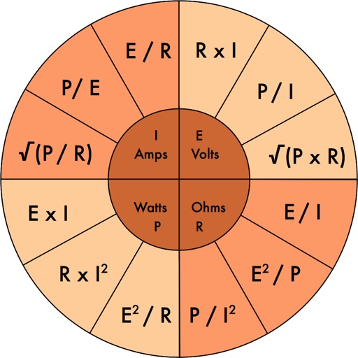
Access electrical codes and standards for residential, commercial, and industrial applications. Search for wiring diagrams, safety protocols, and equipment specifications. View detailed explanations of electrical systems and components.
Measure distances, land areas, and perimeters using satellite maps. Calculate perimeters and track outdoor projects. Measure routes for biking, golfing, or racing. Save and share measurement data.
Calculate dimensions, convert units, and perform angle and rafter measurements. Estimate material quantities and layout stairs. Input measurements for precise calculations. Save and reuse formulas for repeated tasks.
Measure atmospheric pressure using the device's barometric sensor. Determine elevation with GPS-based altimeter. Access a ruler, surface level, metronome, stopwatch, timer, and seismometer. Includes flashlight.