Explore celestial bodies with 3D and historical imagery maps. Measure distances, areas, and altitudes. Plan routes for driving, cycling, or walking. Add points, lines, and text annotations. Import/export KML, KMZ, and SHP files.
by Anhui Yiyebianzhou Network Information Technology Co., Ltd.★ 0.00 ratingsNavigationFreeData updated 2026-09-20
The app offers downloadable maps and guides for the Tuscan-Emilian Apennines, covering areas from Reggiano to Mantovano. Users can view their GPS location, record routes, and add personal notes for points of interest like springs or mushroom spots.
Explore self-guided walking tours with detailed city maps. Discover attractions and hidden spots. Locate points of interest and navigate efficiently. Track your route and save favorite locations. Share tour experiences with others.
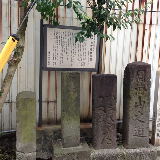
The app introduces users to historic spots in Hodogaya, Japan, using a map interface. It allows users to explore the town's historical locations while walking.
View real-time status of tunnels and roads, including closures and openings. Check traffic messages affecting specific routes. Monitor status for over 30 tunnels in Oslo and surrounding areas. Provide updates on road conditions and accessibility.
Calculate public transport routes within Zaragoza.
The app calculates selected public transport routes within Zaragoza. It allows users to plan trips using real-time information for buses and trams, considering user preferences for time and day.
Provides maps for navigation without internet connection. Zoom in at any level with detailed vector maps. Avoid roaming charges by using local data. Locate nearby points of interest and plan routes. Save data usage by avoiding international roaming.
The app provides nautical charts for Finnish sea and freshwater areas. Users can view approximate locations, marina information, and create points of interest.
The app converts coordinates to UTM EGSA87 Datum and calculates polygon area in square meters. Measurements can be sent via email in DXF, KML, or TXT file formats.
The app offers walks through rural areas and estates in Utrecht and Gelderland. Users can discover local stories through videos, audio clips, and historical documents on routes ranging from 5 to 15 kilometers.
Navigate using offline GPS charts and plot routes. View real-time position, speed, and depth. Mark waypoints and track progress. Share maps and charts securely. Set alarms for tides and weather. Sync with external devices for accurate .
Plan and manage multi-stop routes with customizable stops and path optimization. View real-time traffic and alternate routes. Save frequently used locations and receive step-by-step navigation instructions.
Explore hiking trails with detailed offline maps and route guidance. Access information, wildlife facts, and historical stories. View trail difficulty levels and recommended equipment. Save favorite locations and navigate without internet connection.
The app provides an offline travel guide with interactive maps, augmented reality features, and daily itineraries. It includes information on points of interest, shopping, nightlife, and safety tips for users.
Search destinations, get shortest routes, navigate
Find locations and plan routes using a 2D map. Search for points of interest or destinations. View the shortest route on the map. Navigate with a simplified interface.
Measure land , distance, and perimeter using GPS and satellite maps. Define boundaries by placing points or walk the perimeter for hands-free tracking. Save and export measurement data for professional use.
Track bus arrivals in real time with estimated arrival times and route maps. View timetables for Dart and Luas routes. Receive updates on service disruptions and delays. Navigate using interactive maps and schedule pickups.
Explore historical sites with interactive maps and audio guides. Learn about Madame De Clercq's influence through narrated trails. Access additional trails for other historical routes. Share findings via social media.
Explore with offline guides and self-guided walking tours. Listen to historical stories and secrets as you walk. Trigger commentary based on your location without needing internet.
The app provides a system for regularity competitions, including historical and sport regularity, and raids. It allows users to enter times, link distances, program route cards, and add averages.