iPlotter Solent
Colin Porteous
Plan routes with waypoints and calculate true
Create passage plans by selecting waypoints from a database. Calculate true course and distance. Automatically determine magnetic variation and derive magnetic heading.
Find optimal routes and track metro status
Navigate using real-time subway maps with 2022济南 metro lines. Find optimal transfer routes with estimated time, cost, and distance. Save or share route details as text or images. Bookmark favorite stations and lines.
Showing 921–940 of 1,000 ranked alternatives.
Colin Porteous
Plan routes with waypoints and calculate true
Create passage plans by selecting waypoints from a database. Calculate true course and distance. Automatically determine magnetic variation and derive magnetic heading.

MOTORLINE ELECTROCELOS S.A.
Explore trails and discover hikes
Explore hiking trails, cycling paths, and running routes in Gerês, Vieira do Minho, and surrounding areas. View detailed descriptions, photos, and route statistics including distance, duration, and difficulty.
Yasir Majeed
Search destinations, get shortest routes, navigate
Find locations and plan routes using a 2D map. Search for points of interest or destinations. View the shortest route on the map. Navigate with a simplified interface.

Hirataka Saito
Capture skyline views from 58 spots
View 58 designated viewpoints around Tokyo Skytree within a 5km radius. Search by map or current location to find spots with clear views, free from obstructions like power lines.

Norkart AS
Find addresses and get routes
View detailed maps and aerial images of Norway with no daily download limits. Search for addresses, places, and properties. Get turn-by-turn navigation and route descriptions. Access extra detailed municipal maps for eligible areas.
Joerg Holz
Explore maps with detailed trails and points
Customizable maps with detailed contour lines and small path visibility. Display POIs in categories as layers. Adjust icon size and overlap for clarity. Search for POIs, streets, towns, and villages.

Riber Shamo Elias
Calculate routes and track positions
Convert nautical miles, kilometers, miles, meters, and feet for distance calculations. Convert knots, km/h, or m/s for speed measurements. Calculate wind force and sea state parameters. Display results in clear, easy-to-read formats.

Mapgears Inc.
Track , navigate routes, and log rides
Access trail maps, track your route, and view club rules and regulations. Find nearby trailheads and check trail conditions. Receive alerts for weather and trail closures. Share your location with emergency contacts.

Achtsamkeit & Meer GmbH
Monitor position and alerts
Monitor your boat's GPS position to detect drifting. Set location with a single click. Receive instant alerts if your boat moves. Track status and receive notifications when lines are ashore.

Adventure Guide NZ Limited
Explore routes and track your journey
Navigate using preloaded offline topographic maps. Access over 1,000 routes and 4X4 tracks. Find vehicle-accessible campsites, remote huts, fuel stations, and points of interest. View detailed route information and track progress.

iraq techno
Send requests, review, and track changes
Track shipment status in real time. View delivery updates and estimated arrival times. Receive notifications for changes or delays. Manage orders and review request details.

Aidar Haiatov
Find medications and medical services easily.
The app provides a convenient way to search for medications and medical services in Tatarstan. It displays medication availability, stock levels, and prices across pharmacies, showing nearby locations on a map and offering optimal route guidance.

Yaroslav Mykolaienko
Explore attractions and routes
Travel offers detailed information on attractions, including beaches, cultural sites, and local tips. map provides interactive navigation for Metrorail with real-time updates. Users can save favorite locations and receive transit alerts.

ExaMobile S.A.
Track ski speed, distance, and slopes
Track skiing speed and distance. Map ski routes and mark slopes. Record maximum speed and track movement. View detailed statistics on winter sports activity. Sync data with maps for accurate route representation.

Yorkshire Dales National Park Authority
Explore Yorkshire Dales National Park routes.
The app provides route details for the classic 24-mile circular walk and individual peaks in the Yorkshire Dales National Park. It includes safety advice, points of interest, and GPS tracking to show progress along chosen routes.

Bitcliq Technologies S.A.
Explore Caldas da Rainha's Tourist Routes
The app presents touristic routes managed by the Caldas da Rainha Tourism Department. It includes sign language, content vocalization, and multiple languages, with user-created route options and information on local activities.

SEED corporation
Find parking near your destination
Find nearby coin parking lots based on location and price. Search for affordable options near destinations. Use AI to recommend optimal parking spots. View pricing details and distance from destination. Pay with digital wallet or cash.

Anhui Yiyebianzhou Network Information Technology Co., Ltd.
Explore celestial bodies with 3D maps
Explore celestial bodies with 3D and historical imagery maps. Measure distances, areas, and altitudes. Plan routes for driving, cycling, or walking. Add points, lines, and text annotations. Import/export KML, KMZ, and SHP files.

Cheng-Jie Sun
Taichung bus real-time information.
The app provides real-time bus arrival information for Taichung City. It includes weather forecasts, selected stops, route searches, station maps, and route planning.
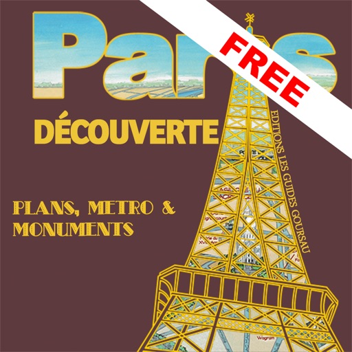
Jerome Goursau
Discover Paris with a 3D map.
The app presents a hand-drawn 3D map of Paris, showing major sites and attractions. It provides details for attractions and includes a metro map to aid navigation.
Apps are ranked by functional similarity, category fit, rating confidence, and popularity.