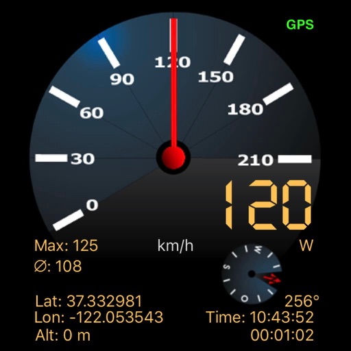
Track speed with a graphical dashboard and analog/numeric display. View current location, weather, and temperature in Celsius or Fahrenheit. Switch between kilometer and mile units. Customize dashboard colors and use an analog compass.
by Unicom TOV★ 4.61,755 ratingsUtilitiesFreeData updated 2026-09-06
Navigate with voice-guided turn-by-turn directions in multiple languages. Plan door-to-door routes. View upcoming maneuvers and distances. Access offline for 200+ countries. Receive speed limit and camera warning alerts.
Monitor vehicle health with real-time diagnostics. Inspect ignition, exhaust, and electronic systems for faults. View fault codes with three severity levels. Clear stored fault codes from the ECU. Analyze driving patterns to improve efficiency.
Edit GPS data for photos and videos to remove or adjust location information. Set location accuracy levels including ten meters, hundred meters, kilometer, and three kilometers. Select and view GPS data for individual media files.
Calculate speed and distance traveled. Tap the screen to reveal control buttons. Hide buttons after five seconds. View settings and information windows.
Real-time monitoring displays current via a virtual dashboard. Set limits to receive alerts. Track driving history and statistics. Share trip data with others. Syncs with iPhone for accurate GPS readings.
Convert units across 40+ categories with a single click. Switch between metric and imperial systems. Input values and select units for instant . Share results or copy to clipboard.
Monitor network activity with real-time upload and download speeds and traffic data. Display Wi-Fi name optionally. Launch apps from a with support for 6000+ quick starts. Customize for speed dialing and web page access.
Displays speed and distance using GPS. Tracks maximum speed with vibration alerts. Shows position and time of maximum speed on a map. Switches between light and dark modes. Notifies of GPS measurement errors. Supports motorcycles, cars, and planes.
Tracks location, speed, altitude, heading, acceleration, g-force, and atmospheric pressure. Retrieves and displays current weather data. Records tracks up to 10 minutes or 10 kilometers. Plays back tracks at multiple speeds.
Track GPS and GLONASS satellite data including position, accuracy, speed, altitude, and orientation. Save and navigate to locations using coordinates or real-time data. Use a compass with magnetic and true north, a leveling tool, and waypoints.
Track speed using GPS for driving, cycling, motorcycles, and flying. Monitor speed in both landscape and portrait modes. Share maximum speed and GPS coordinates with friends. Use the on-board computer feature for real-time data.
Convert temperatures between Celsius, Fahrenheit, and Kelvin. Input a value and instantly switch units. Display results in selected format. Share converted values via copy-paste or screenshot.
Display weather information via a customizable widget with dark and default background options. Check weather by long-pressing the map. View weather and time globally. Receive notifications when weather changes.
Track the sun's position using augmented reality. View 2D and 3D solar path maps with compass and shadow simulation. Adjust settings for accurate solar projections. Save and share solar data for planning and analysis.
Convert temperatures between Celsius, Fahrenheit, Kelvin, Delisle, Newton, Rankine, Réaumur, and Rømer. Enter a value and select the unit to convert from. Display results in the desired unit.
View current location details including latitude, longitude, altitude, and address in Decimal or DMS format. Track trip data such as distance, speed, and maximum speed. Save location and trip information for later review.
Convert ingredients between mass and volume units, switch between metric and customary measurements, and convert temperatures between Celsius and Fahrenheit. Store and view past . Switch between dark mode and eight color themes.