
Dish Align
Dayana Networks Ltd
Navigation
Dish Align is a simple yet powerful app for alignment of the satellite dish.
Free
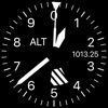
Measure altitude using barometric pressure
by M Butler
Curated apps similar to Altimeter for Aviators, ranked by relevance and user ratings.
Dayana Networks Ltd
Navigation
Dish Align is a simple yet powerful app for alignment of the satellite dish.

Wellsite Navigator, LLC
Navigation
Have a team in the field? Our enterprise accounts offer group discounts, dispatching, and advanced routing tools. Visit wellsitenavigator.com to learn more. Wellsite Navigator is the trusted oilfield navigation app, with over 150,000 users across 38 states in US & Canada.

Plan trips, navigate streets, track location
KICK Design Inc
Navigation
Plan trips with route calculations between locations and stations. Receive real-time service updates via push notifications. View transit schedules and service advisories. Navigate subway systems with clear maps and directions.

Track speed in mph and kmh automatically
Liam Hennessy
NavigationDisplays current speed in both miles per hour and kilometers per hour. Automatically switches speed units based on the country's standard. Shows real-time speed data from the device's sensors.

Track bus routes and real-time arrivals
BUSMAP COMPANY LIMITED
NavigationLook up detailed bus and metro routes. Navigate using smart routing for buses, metro, and other transport. View real-time arrival times and track bus locations. Get auto-reminders for bus stops. Provide feedback on service. Receive live data updates.

Navigate lines and stations
Mapway Limited
NavigationNavigate system with real-time route planning and step-by-step directions. Find nearby stations, transfer lines, and check arrival times. Tap to tap PASMO cards for seamless entry. View maps, zoom, and pan for accurate positioning.

Rent bikes, find stations, track routes
Bicycle Transit Systems, Inc.
NavigationUnlock bikes at 220 stations using GPS. Locate nearby bikes and stations. Start a ride with one tap. View real-time maps and traffic. Track trip distance and time. Pay for rides via . Receive notifications about availability and service alerts.

Find fuel prices and pay less
WEX, Inc.
NavigationFind and pay for diesel fuel using a nationwide fuel map. Compare prices at truck stops like Love's and Speedway. Pay without transaction or monthly fees. Track fuel savings and locate discounted fuel stations.

rdzl
NavigationMakes from your iPhone, iPad, Apple Watch and/or Macbook a complete GPS device with detailed topographic maps.

View , create groups, add widgets
LW Brands, LLC
NavigationView real-time and road conditions using 511 CCTV . Create custom camera groups for frequent routes. Quickly access on your route. Add camera widgets to your home screen for easy viewing.

Track runs, plan routes, record trails
Fitness & Sports apps SRL
NavigationPlan and track ski or snowboard runs with GPS navigation and 3D resort . View detailed trail information and elevation data. Record runs and analyze speed, distance, and time. Share routes and track progress over multiple sessions.

Explore , read guides, offline
OPENPLANIT LLC
NavigationBrowse curated trail guides offline. View detailed maps, photos, and route descriptions. Download trail information directly to your device. Search for by location and difficulty. Save and access trail details without an internet connection.

Book and track your driver
Rhinocorn Inc.
NavigationBook with vehicles in São Paulo. Set pickup and drop-off locations. Track vehicle location in real time. Pay securely through the . Request driver assistance during trips. View trip history and ratings. Schedule regular in advance.

Sakhalin, LLC
NavigationSEAiq Pilot is designed especially for use by river, channel, and harbor pilots. It includes support for charts in the S-57, S-63, iENC and BSB/KAP formats and use of external NMEA/AIS over WiFi. IMPORTANT: For non-pilots, we recommend SEAiq and SEAiq USA. This app is free to download.

Track , distance, and performance
TECHISTIC LTD
NavigationTrack , distance, and performance with real-time GPS data. Display in mph and km. Log trips and view historical records. Set alerts and monitor journey details. Sync data across devices for ongoing performance analysis.

Circuit Routing Limited
NavigationCircuit for Teams is now Spoke Dispatch.

Track fuel prices and manage loyalty rewards
SiteSoft LLC
NavigationTrack fuel prices and view loyalty program benefits. Check bonus balance and virtual card status. Access special offers and calculate vehicle expenses. Register for the "Семейная Команда" loyalty program.

Locations and share them
RAYO INNOVATIONS PRIVATE LIMITED
NavigationLocations with a single tap for precise GPS marking. Share saved locations with contacts. Access locations online or offline. View saved places on a map. Edit or delete saved locations.

Fuzhou Lexun Network Technology Co., Ltd
Navigation这是一款面向户外爱好者的GPS实时海拔测量应用,它提供强大的GPS实时海拔显示、当前坐标实时经度纬度显示、实时手机指南针功能,全球地震云播报,适合户外爱好者在国内外旅行、长短途徒步、登山、跑步、自驾越野、滑雪、户外摄影、野外寻宝露营以及其他户外活动时用作海拔记录与查看,还能把带着海拔信息的水印照片与好友及时分享。目前已集成各种卫星地图及标准地图。

NorCross Marine Products, Inc
NavigationIntroducing the HawkEye® FishPod® Series; smart fish finders based on our Boat Mount and Portable technologies that are designed to evolve as you evolve.
App information from Apple App Store. Altimeter for Aviators and related trademarks belong to M Butler.