CSJ GPS app icon

Apps Like CSJ GPS for iPhone and iPad

by 泽生 王★ 3.514 ratingsUtilitiesFreeData updated 2026-09-17

CSJ GPS screenshots

Ranked alternatives

Showing 301–320 of 1,000 ranked alternatives.

  1. Aircraft Heading app icon

    Aircraft Heading

    Sean Flanagan

    Track with realistic indicator

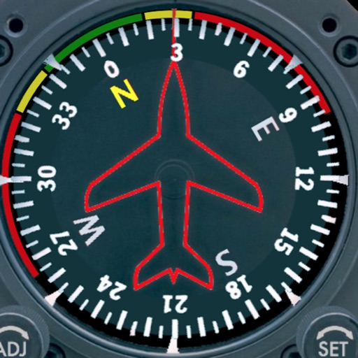
    Displays a photorealistic -style indicator with both analog and digital readouts. Users can toggle rotation lock, simulate the instrument indoors, and view improved graphics. Supports latest iOS versions and includes bug fixes.

    ★ 2.212 ratingsNavigation$0.99Data updated 2026-11-09
  2. Contera Mobile app icon

    Contera Mobile

    Costar Video Systems LLC

    Access HD video from your server

    Access HD video from Arecont Vision Server software. Manage user permissions, access recorders, and adjust settings without manual configuration. Stream video directly and use tools to simplify system management.

    ★ 5.014 ratingsUtilitiesFreeData updated 2026-09-14
  3. Skids Up app icon

    Skids Up

    Air Medical Technologies LLC

    ★ 0.00 ratingsUtilitiesFreeData updated 2026-09-06
  1. Crewchief GA app icon

    Crewchief GA

    Crewchief Systems, LLC

    Manage aircraft data and compliance

    Manage aircraft data with real-time tracking of operations, maintenance records, and regulatory compliance. Share updates with stakeholders, monitor manufacturer recommendations, and ensure adherence to safety standards.

    ★ 4.816 ratingsUtilitiesFreeData updated 2026-09-18
  2. KMEye app icon

    KMEye

    Guangzhou Kedi Intelligence Technology Co., Ltd.

    Stream live video, control cameras, view encoders,

    View live video streams from cameras and encoders. Control pan, tilt, and zoom. Save snapshots to the photo gallery. Connect directly without third-party servers. Support landscape and portrait modes. Authenticate access.

    ★ 3.722 ratingsBusinessFreeData updated 2026-09-08
  3. GPS Stone app icon

    GPS Stone

    Francois Lamboley

    Record and export all user trips.

    The app records and exports user trips for geo-tagging or trip management. It displays live paths on a map and provides details like speed, distance, and altitude.

    ★ 3.67 ratingsNavigationFreeData updated 2026-09-11
  4. RemoteFlight MAP app icon

    RemoteFlight MAP

    Vladislav Oupicky

    Map follows aircraft in simulators.

    The app provides a zoomable map that follows the aircraft's position during flights in simulator programs. Key flight variables are displayed on a side panel, and users can customize map types, aircraft icons, and units of measurement.

    ★ 3.05 ratingsUtilities$4.99Data updated 2026-09-20
  5. Cloud Topper app icon

    Cloud Topper

    Crop Applications, LLC.

    Determine cloud height using device sensors.

    The app uses a device's camera, gyroscope, and accelerometer to function as a sight level. Users can input the distance to a cloud, and the app calculates the height above or below it, correcting for the Earth's curvature.

    ★ 2.77 ratingsUtilities$1.99Data updated 2026-10-03
  6. MultiCam+: Front & Back Camera app icon

    MultiCam+: Front & Back Camera

    Kenneth Kao

    Record videos with dual cameras simultaneously

    Record videos using and cameras simultaneously with dual output, picture-in-picture, side-by-side, split screen, or diagonal layouts. Swap cameras during recording and adjust picture-in-picture settings.

    ★ 4.323 ratingsPhoto & Video$1.99Data updated 2026-11-14
  7. Boeing Interactive QRH app icon

    Boeing Interactive QRH

    The Boeing Company

    Access QRH data and checklists

    Access checklists, performance tables, and maneuvers for aircraft. Customize checklists with tail number-specific data. Adjust font size and enable night mode for better readability.

    ★ 3.24 ratingsBusinessFreeData updated 2026-09-08
  8. NetSee app icon

    NetSee

    Beijing Ithink Imagination Technology Co., Ltd.

    ★ 2.718 ratingsBusinessFreeData updated 2026-09-12
  9. Leveler Plus app icon

    Leveler Plus

    Heng Jia Liang

    Measure angles, track levels, save readings

    Measure pitch and roll angles using a bubble level. Display time, date, and compass for reference. Save angle measurements with screen capture. Alternative bubble reading method for accurate readings. Simple and intuitive interface for quick use.

    ★ 5.01 ratingsProductivity$2.99Data updated 2026-09-06
  10. Gogo DASH (Biz Av) app icon

    Gogo DASH (Biz Av)

    Gogo Business Aviation LLC

    Check aircraft system status and network.

    The app allows users to check system status and network availability for Gogo-equipped aircraft. It provides access to network monitoring, system health, product documentation, and coverage maps.

    ★ 4.97 ratingsTravelFreeData updated 2026-10-03

How we rank alternatives

Apps are ranked by functional similarity, category fit, rating confidence, and popularity.