Display LRF measurements and trigger them remotely. Set the number of measurements and choose units (meter or yard). Adjust display brightness settings.
by Steiner-Optik GmbH★ 0.00 ratingsProductivityFreeData updated 2026-09-16
Dimensions, spacing, and angles in screenshots and photos. Analyze color values, grid alignment, and element positions. Export measurements and compare dimensions across images.
Control home heating via Bluetooth. Adjust temperature settings remotely. Set personalized heating schedules. Automatically reduce temperature when unoccupied. Monitor and manage radiator functions from a mobile device.
The app offers a display interface for Raritan PX2, PX3, PX3TS, BCM, PMC, or EMX devices. Users can access power measurements, device status, and network settings on their iPad or iPhone.
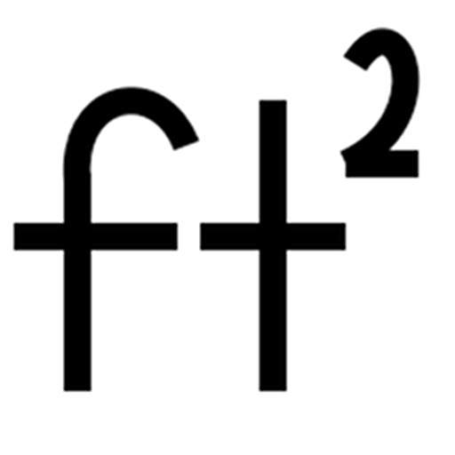
Calculate fluid rates, pipe diameter, or liquid velocity. Choose units for diameter, velocity, and . Set decimal precision for results. Solve equations for accurate measurements.
Measure short lengths with precision using a digital . Switch between inches and centimeters. Calibrate measurements for accuracy. Adjust units and view results on a clean, intuitive interface.
View schedules, set reminders, learn recycling rules
View garbage, recycling, and yard debris collection schedules. Receive collection notifications and set reminders. Learn proper recycling guidelines and what items are allowed or prohibited.
Measure dimensions, angles, and distances using augmented reality. Tap the camera to scan objects and receive precise measurements. Save and share measurement data. Sync with other devices for collaborative projects.
Display full schedules with time and location on monthly views. Set multiple combinations and switch between them with a single button. Register recurring events using templates by double-tapping a date.
Calculate footage by entering length and width for multiple rectangles. Support measurements in , inches, or both. Export calculations as CSV for further use.
Track and distance and area using a map-based interface. Record routes manually or automatically. Export measurements as GPX, CSV, or PDF. Open and view GPX files. Enable location to start movement or edges.
Use AR technology to measure lengths, heights, and angles by pointing the camera at objects. Capture and save measurements with the photo . Check alignment using the built-in level tool.