Access real-time hurricane updates, view storm surge zones, locate evacuation centers, and find emergency bus pickup sites. Check the Miami-Dade County Hurricane Guide for preparedness tips and additional emergency resources.
by Miami-Dade County★ 4.312 ratingsWeatherFreeData updated 2026-09-15
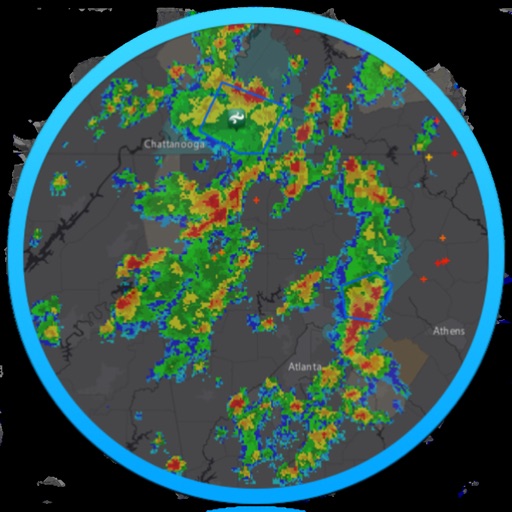
The app provides 18 world radars and a local radar with NEXRAD technology. It includes forecast and hazard warnings, projected storm paths, lightning intensity, sea temperatures, and cloud formations.
View real-time radar and satellite imagery for weather tracking. Explore interactive maps with vertical and horizontal views. Access color-coded alerts by severity. Check the Road Weather Index for road conditions.
Submit questions, listen to interviews, track racing
Listen to weekly interviews with Mello Yello Drag Racing Series winners and newsmakers. Get expert analysis and behind-the-scenes content. Submit questions and opinions between events. Follow drivers and crew as they discuss racing topics.
Receive real-time updates on Kurdish and Middle Eastern news. Access 24-hour headlines, breaking news, and live coverage. Submit news tips, photos, or stories through the interactive YourRudaw feature.
Access local news, events, and community updates for . Read articles, view photos, and explore special sections. Subscribe for e-edition access matching print layout. Stay informed about sports, business, and entertainment.
The app provides marine weather data including wind speed, surf, and wave height for coastal zones in the United States. It offers one-touch National Weather Service forecasts for today, tonight, and the week, along with small craft advisories.
Track wildfires in real time with maps showing current fire locations and spread. Receive alerts from verified sources including current and former firefighters. View detailed reports and updates from first responders and reporters.
View real-time images and forecasts for current conditions. Track storms, monitor precipitation, and check temperature and wind data. Receive alerts for severe events. Customize alerts based on location and type. Share data with others.
Check current and forecasts for your city and global locations. View temperature, wind, and radar data. Receive alerts and track storms. Monitor local air quality.
Check real-time forecasts and wind speeds at various altitudes. Access KP index and customizable limits. View no-fly zone maps and wind compass directions. Receive pre-flight reports to identify potential hazards.
Check current conditions, including temperature, precipitation, and wind speed. Access a 16-day for upcoming trends. View live maps for real-time rain tracking. Set location-based alerts for changes. Share updates via social media.
Check air quality for your current location and up to 10 custom locations. Receive notifications when air quality changes. View hourly data from the Real-Time Air Advisory Network. Add or remove locations and personalize settings.