
Altimeter - altitude and more
22of8 GmbH
Track and save route points
Measure current and track elevation changes. Save named locations with icons for easy navigation. Syncs across iPhone, iPad, and Apple Watch. No ads and free to use.

Drag to measure routes and track distance
Measure distances by dragging a finger across the map to calculate route lengths. Center on current location with the locator button. Clear routes by shaking, using the trash button, or dragging again.
Showing 241–260 of 1,000 ranked alternatives.
22of8 GmbH
Track and save route points
Measure current and track elevation changes. Save named locations with icons for easy navigation. Syncs across iPhone, iPad, and Apple Watch. No ads and free to use.

Ahmed Musawar
Plan trips, discover places, create itineraries
Create personalized itineraries by selecting destinations and activities. Add attractions, restaurants, and experiences. Save and share trips. Sync with Google Maps. Receive real-time updates on events and closures.


Paul Hofmann
Find the right club for distance.
The app helps golfers determine which club to use for specific distances. Users can save their shot distances and choose between yards or meters for display.

Gilbert Montane Pinto
Find, save, and navigate locations
Know current coordinates and address. Save and view favorite locations with categories. See routes to saved or searched locations from current position. Share current or saved locations via Mail, SMS, and WhatsApp.

Roads & Transport Authority
Find routes with public transport
Find real-time public transport routes using buses, marine, metro, tram, taxis, e-hailing, and cycling. View step-by-step directions and estimated travel times. Access live service updates and plan multi-modal journeys.

bergfex GmbH
Track hikes, ski tours, and outdoor routes
Find hikes or ski tours tailored to your preferences. Create and save personalized routes using the route planner. Track outdoor activities with precise GPS navigation. Access detailed maps for the Alpine region.


Kinexa Inc
Track vehicles, optimize routes, manage safety
Monitor vehicle locations, speed, and other data in real-time via an interactive map. Plan efficient routes to reduce fuel use and delivery times. Track behavior and ensure ELD compliance with safety monitoring tools.

Gohel Prakashbhai
Areas, track routes, and navigate efficiently
Calculate distances and areas using GPS. route lengths and track movement. Access GPS Camera, Compass, and Speedometer for navigation. View Satellite, Normal, Terrain, and Hybrid maps. Locate nearby points of interest and monitor live positions.

Alex Perez
Track bus locations and receive real-time updates
View real-time bus locations and time predictions for Georgia Tech Stinger and Tech Trolley. Receive push notifications for delays and closures. Search for campus buildings and view their footprints.

Muhammad Mohsin
Measure objects with AR precision
Measure physical objects and distances using augmented reality. Tap to capture point-to-point measurements. Choose metric or imperial units. Save and store measurements for future reference.

Spare Labs Inc.
Book microtransit rides and connect to bus
Book microtransit rides via DMTS to hub locations or direct destinations. Choose between one cost for hub access or another for direct travel. Connect to main bus routes for seamless transportation. Track ride details and manage bookings within the .
嵩 张
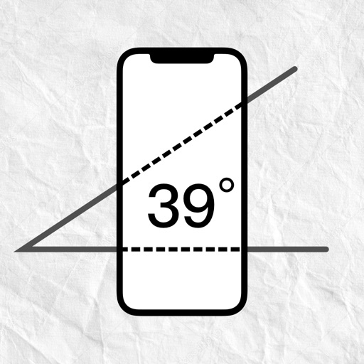
Measure angles with device and lines
Measure angles by placing the device on the desired surface and adjusting two lines to align with the angle's sides. Display degrees in real time without needing photos or overhead placement.

BELKALABS PTE. LTD.
Measure rooms, create plans, scan spaces
Use and AR to scan rooms and create 3D floor plans with precise measurements. Measure distances, heights, and lengths in real time. ccurate layouts for planning furniture or renovations.

Stephen McBride
Track bus arrival times and routes
View real-time bus arrival times for routes. Add and manage favorite stops for quick access. Filter routes and view map previews. Check schedules for both Bus and Go-Ahead Ireland services.

NAMSUNG AMERICA, INC.
View GPS receiver status and data.
The app displays GPS receiver information, including satellite status, current location, and battery level. It allows users to manage route recording and download stored routes from the receiver.

ProLogs Solutions, LLC
Track vehicle routes and compliance data
Track vehicle locations in real time and view exact route history for up to 90 days. Record driving time and hours of service automatically. Monitor compliance with regulations and manage driver logs remotely.


ObjectGraph LLC
View GPX tracks and see elevation changes
View GPS tracks for hiking, cycling, and running with an interactive map and elevation-based color coding. Open standard GPX files to see routes and access detailed statistics. Display tracks with a simple, read-only interface.
Apps are ranked by functional similarity, category fit, rating confidence, and popularity.