The app displays detailed satellite imagery of the United States with offline map capabilities. It provides a moving map display using GPS tracking, labeling geographical features and points of interest.
Track elevation and climb rate in real-time. Calibrate altitude settings and check GPS accuracy. Send location links via SMS for easy sharing and navigation assistance. View maps in web browsers for location tracking.
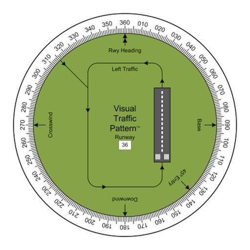
Allows pilots to view runway patterns with finger rotation. Display includes left and right patterns, crosswind, downwind, base, and 45-degree entry headings. Magnetic runway orientation matches aircraft heading for approach visualization.
Measure in real time using GPS and sensor data with less than 3-meter error. Track air pressure and oxygen concentration. Customize themes for personalized backgrounds.
Measure altitude using barometric pressure and GPS data. Display altitude in feet and meters with real-time accuracy. Calibrate sensor and switch between day and night display modes.
The app visualizes the sun's path throughout the day or year. It predicts and plans for twilight times, solstices, and equinoxes, providing sun shadow information.
Allows users to access and monitor iPhone sensors like GPS, accelerometer, gyroscope, and barometer. View real-time from each . Export readings as CSV files. Create custom combinations and visualize graphs.
Visualize lighting fixtures in any environment using augmented reality. Select and customize products by adjusting orientation, color, and shape. View 360-degree perspectives from any angle. Share designs and receive feedback for project decisions.
The app provides data-driven debriefs for pilots, analyzing flights into segments to evaluate performance. It offers maneuver scoring, reviews of flight data, and chart overlays to identify areas for improvement.
Displays wind rose and location details including name, latitude, longitude, and altitude in meters or feet. Saves position data for any global location. Requires location services to detect geographical position.
Reader tool allows users to read and listen to books. Ruler tool measures length, breadth, and height of objects. Protractor tool measures angles of objects. Slope tool calculates the incline of structures. Activity track daily tasks and progress.
This displays directions in Japanese or English with a single tap. It shows 16 directional points, precise angles in degrees, and supports switching between cardinal names and abbreviations.