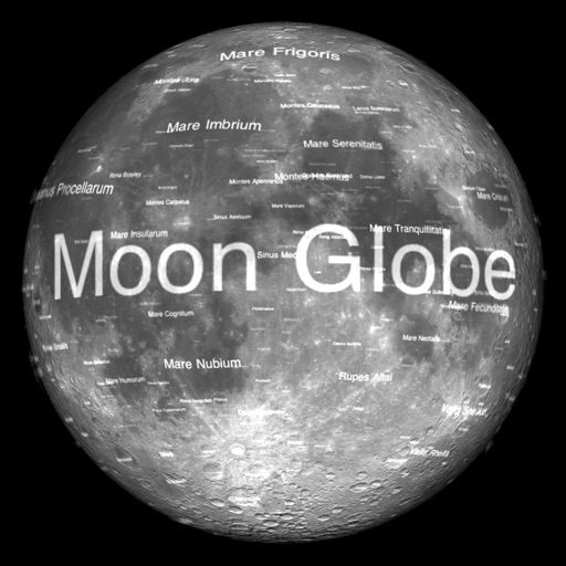
Moon Globe
Michael Howard
View Earth's Moon in 3D.
The app renders the Moon in realtime 3D using satellite imagery and topographic data. Users can manipulate the view, adjust sunlight, and see labeled terrain features and spacecraft.

Showing 161–180 of 1,000 ranked alternatives.
Michael Howard
View Earth's Moon in 3D.
The app renders the Moon in realtime 3D using satellite imagery and topographic data. Users can manipulate the view, adjust sunlight, and see labeled terrain features and spacecraft.



Nicolas Schotten
Create maps, add pins, share codes
Create unlimited maps and add pins, emojis, and images to each. Share maps with friends via code. Never forget locations with visual markers and personal notes.

Magic Lamp Technologies Limited
Find collectibles and explore
Find all collectibles and locations in , including TM's, Ominous Stakes, Legendary Spawns, and Tera Spawns. Explore 50+ categories like Gimmighouls and Shrines. Search locations by name and sync progress with the website.

KIET NGUYEN TAN
Track , share , land areas
Track real-time and share it with friends. Copy coordinates and perform actions on . land area using GPS and calculation tools. Find routes with distance and direction calculations.

RipCharts, LLC.
Track fish activity and view maps
View and analyze satellite imagery for fishing conditions. Locate and track fish populations. Set waypoints and save maps. Share images and data with other users. Receive real-time updates on weather and currents.


Magic Lamp Technologies Limited
Find locations and track progress in Egypt
Explore an for AC: featuring 1000+ locations including collectibles, Viewpoints, and Side Quests. Filter by 45+ categories like Treasure and Legendary Gear. Use Quicksearch to find locations by name.

Red Sky Engineering, LLC
Outdoor navigation for iPhone and iPad.
The app provides outdoor navigation with satellite, road, and hybrid maps. An in-app subscription unlocks USGS 24k Topo charts, navigational features, and frequent upgrades for outdoor pursuits.

Bryce Cogswell
Create and edit OpenStreetMap data.
The app allows users to create and edit information in OpenStreetMap. Users can add points of interest, streets, paths, buildings, and bodies of water, with full undo/redo support and offline capabilities.


Bhavik Savaliya
Find routes, track location, view maps
Allows users to plan routes for driving, bicycling, or walking. It displays real-time navigation with live traffic updates. Users can find nearby hotels, schools, and hospitals. The calculates distances between locations and shows current map views.


Samip Ukani
Explore 360 views and navigate streets
Explore locations with 360° panoramic views. Navigate using photo spheres and photo paths. Access for detailed surroundings. Share and save panoramic images. Sync with maps for real-time navigation.

Magic Lamp Technologies Limited
Find collectibles and track missions
Find collectibles, stunt jumps, side missions, prepper stashes, and perk magazines across over 1000 locations. Search by name for quick access. Sync progress with a website. Track progress and view detailed maps.


Mappendix Limited
Download maps, plan routes, record tracks.
The app offers unlimited free map downloads based on Ordnance Survey OpenData, with options for paid map downloads. It allows users to mark waypoints, plan routes, record tracks, and import/export GPX files.
Apps are ranked by functional similarity, category fit, rating confidence, and popularity.