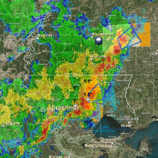
The app offers detailed local forecasts for Tennessee, Arkansas, and Mississippi. It includes a high-resolution radar with future radar, earthquake, and storm tracks, plus free push alerts for over 25 types.
View real-time high-resolution for storm and precipitation tracking. Access global forecast models for detailed predictions. Monitor air quality and receive accurate forecasts. Track severe patterns and plan accordingly.
View real-time radar, temperature, and surface wind data on an interactive map. Access 48-hour and 10-day forecasts by city, zip code, or current location. Watch live meteorologist streams for up-to-the-minute updates.
The app provides neighborhood forecasts, live radar with future storm paths, and breaking weather alerts. Users can track earthquakes and storm tracks, and access current conditions, hourly, and daily forecasts.
Track hurricanes with real-time data and forecasts. View interactive maps showing storm paths and advisories. Receive live updates and spaghetti models. Set alerts for storm impacts. Access NHC data for accurate tracking.
View real-time buoy observations from 800+ NDBC buoys. Check forecasts for over 300 zones. Access tide predictions and current hourly forecasts. Save favorite buoys and locate the nearest one. Sync data across all devices.
View radar data and severe weather products for real-time storm tracking. Analyze single-site radar images and detect mesocyclones. Save and share observations. Access additional features with optional subscriptions.
View current conditions and hourly forecasts. Access high-resolution satellite imagery and 250-meter radar. Save favorite locations. Receive video forecast updates and blogs. Track future radar movements.
Get real-time rainfall amounts and view past daily and hourly totals. Track multiple locations and check monthly or yearly rainfall data. Compare current rainfall to averages and estimate muddy ground conditions.
The app provides wind speed and direction, sunrise/sunset times, and temperature. Users can view hourly and daily forecasts, select units for wind speed and temperature, and choose compass declination.
Access real-time weather data and live wind reports for sailing activities. View for racing, sailing, and cruising. Locate Tempest Weather Systems near shore markers, buoys, piers, yacht clubs, and waterfront areas.
Track weather conditions at fishing locations using real-time observations and . Access local weather data from Tempest Weather Systems and government sources. View Nearcast predictions and supplement with reports from AWOS, ASOS, METAR, and NWS.
View current conditions through curated photos showing real-time like rain, snow, or sun. Check forecasts for temperature and conditions. Share or save "Wow" photos. Capture and upload your own -related photos for others to see.
The app provides weather information for chosen locations with customizable settings and alerts. It includes interactive radar, future doppler, localized alerts, and video forecasts powered by WPLG Local 10 meteorologists.
Access real-time weather forecasts with 7-day NOAA data. Tap any location for precise , wave, and weather details. View overlays for comprehensive coverage. Check point and zone forecasts based on NDFD data.
View and download NOAA electronic navigational for offline use. Access in NOAA or ECDIS formats. Overlay NOAA weather for real-time conditions. Display buoys, beacons, lights, and natural/man-made features. Track radar and fog signals.
Track current speed and direction from nearby locations. View real-time data from Tempest Systems and government sources. Access nearcast forecasts and historical reports. Set location-based alerts for changes. Share updates with others.