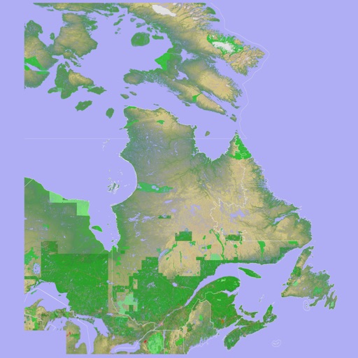
Scenic Map Eastern Canada
Mark Granger
3D topographic map of Eastern Canada
The app presents a 3D topographic map of Eastern Canada. Users can download map data for use without an internet connection, suitable for various travel methods.

View topographic offline
View topographic of the United States with options for standard or hybrid map sources. Download for offline use and track current location on the map. Navigate using map features and explore terrain details for outdoor activities.
Showing 601–620 of 1,000 ranked alternatives.
Mark Granger
3D topographic map of Eastern Canada
The app presents a 3D topographic map of Eastern Canada. Users can download map data for use without an internet connection, suitable for various travel methods.

Ian Muriss
Find POIs, view routes, navigate offline
Find Points of Interest with detailed categories including hotels, restaurants, hospitals, and tourist attractions. Search for locations, view , and access offline routes and POI data.


Boterham
Read, create, and share GPX maps.
The app reads GPX files and displays details for Waypoints, Routes, and Tracks. Users can create maps by adding places with notes and get directions.

Klaus Neuendorf
Track routes and analyze speed data
Record driving routes with GPS tracking. View speed, distance, duration, and average speed. Analyze maximum speed, acceleration times, altitude changes, and stops. Display data in charts for performance review.


Mapotic s.r.o.
Explore attractions and quests
Explore Swiebodzin with interactive maps and trails. attractions, monuments, and hiking paths. Access bike trails and military monuments. Participate in quests to learn about history and local legends. View wildlife and nature spots.


Patrick Tudor
Navigate with geodetic precision waypoints.
The app provides GPS waypoint navigation with geodetic precision. It supports six coordinate formats, compass navigation, and GPX file import/export.


Josef Lischka
Find and your location
Display current location with city, country, and coordinates. custom-named locations for parking spots or hiking trails. exact coordinates with others. View map with minimal interface.


Oratu, s.r.o.
Explore peaks with augmented reality.
The app integrates mapping technology and augmented reality for outdoor experiences. It offers an offline peak database, AR peak visualization, and multiple map providers and types.



Apps are ranked by functional similarity, category fit, rating confidence, and popularity.