Capture photos with GPS coordinates, latitude, longitude, and altitude. Add local date and time based on location. Include street address and optional Unicode characters for direction and position. Stamp photos with UTM/MGRS coordinates.
To DVD or create ISO files. Support popular formats like MP4, MKV, AVI, MPG, WMV, MOV, FLV, and AVCHD. Import high-definition . Search and connect digital cameras.
Track and share hunting, fishing, and trapping experiences. Log harvests with GPS coordinates or map nearby catches. Store unlimited photos, notes, and stories. Share detailed accounts and preserve adventures for future generations.
Control drones, view real-time video, record photos
Control a four-axis drone via WiFi. View real-time video feed from the drone's camera. Capture photos and videos using the device. Enable VR mode for immersive viewing. Use voice commands for flight control.
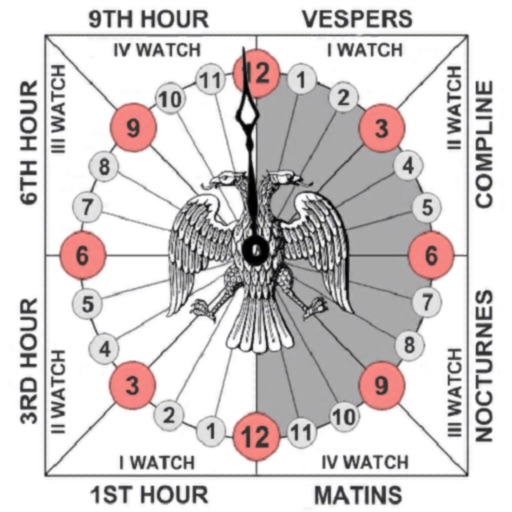
Track prayer times based on time calculations. Adjust for location using GPS or manual input of coordinates. Display times in 12-hour format starting at evening. Include historical context about ancient Judean timekeeping methods.
The app displays global seismic activity with color-coded markers for magnitude identification. Users can view occurrence time, location, depth, magnitude, and place for each earthquake.