

Apps Like uvGO for iPhone and iPad
Plan trips, manage missions, track flights
Plan and manage aircraft missions with DIY trip creation and editing. Add flight legs to build itineraries. Access shared trips for team collaboration. Coordinate complete missions with Universal Weather and Aviation's tools.
uvGO screenshots
Ranked alternatives
Showing 141–160 of 1,000 ranked alternatives.

Overland Bound One: Maps & GPS
Overland Bound Inc
Plan trips, navigate trails, and map routes
Plan trips with offroad and trail data. Access offline GPS navigation and camping locations. Find fuel and water resupply points. Connect with local users and join events. Track routes and share trip details.


Genesis PRO
Aircraft Performance Group, LLC
Plan flights, track performance, access real-time data
Plan flights with real-time performance data and predictive analytics. Input aircraft details to calculate fuel consumption and optimal routes. Access weather information and regulatory data.

SocialFlight
SalesApproach, Inc
Explore aviation events and destinations.
The app maps over 20,000 aviation events, destinations, and airport restaurants. It also offers FAA WINGS and IA renewal courses, and a FLY2WIN challenge with rewards and prizes.


AirTraffic flight tracker
Stephane Coutant
Track flights and view aircraft movements
Track flights with real-time aircraft positioning on an interactive map. View details including airline, number, times, altitude, speed, and heading. Access AI-generated aircraft visuals for realistic representation.

Solar Alert: Protect your Life
Genial LLC
Monitor space weather and receive alerts
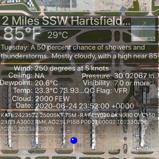
Monitor activity and space weather events. Receive alerts for potential hazards. Track radiation levels and geomagnetic storms. Provide safety recommendations for travel and infrastructure.



AutoDens
Optobyte AG
Calculate air density in real time
Calculates air density, relative humidity, and air pressure automatically. Displays geographic position, temperature, dewpoint, elevation, and barometric pressure. Supports airport and manual input modes.

WeatherWise.app
Interactive Weather Limited
Track storms, forecast weather, stay informed
View radar data with high-resolution images and forecasts. Track severe weather patterns and receive alerts. Access professional tools like Triple/Quad View Radar Visuals for detailed analysis.


Paragliding Map
Paragliding Map Limited
Track flight data and view live webcams
View real-time flight conditions and site information. Explore launch and landing sites globally. Access weather forecasts from multiple providers. Watch live webcams and view photos of locations. See valley wind patterns with directional arrows.

Spartan Forge: Hunt
Spartan Forge LLC
Find land boundaries and units
Plan hunts with detailed LiDAR maps, satellite imagery, and deer movement predictions. Access land boundaries, ownership data, and parcel change alerts. Customize LiDAR layers and overlay crop data for strategic scouting.

Paddle Ways - Lets Go Paddling
onwater llc
Plan trips, track conditions, find spots
Find and plan trips with real-time water condition updates. Search for lakes, rivers, and kayak parks. Set trip dates and receive weather forecasts. Track progress and save favorite locations. Share routes and access safety tips.

Jeppesen FliteDeck Pro
Jeppesen
Navigate, plan, and execute flights efficiently
Navigate using high fidelity airport maps and enroute displays. Access aeronautical data for flight planning. Streamline operations with integrated electronic flight folders. Monitor fuel efficiency and situational awareness during flights.
How we rank alternatives
Apps are ranked by functional similarity, category fit, rating confidence, and popularity.